The Term LiDAR (Light Detection & Ranging) has a long history, beginning with its invention as “Light radar” in the 1960s just after lasers were invented. LiDAR in a basic form was used in 1971 as a laser altimeter to measure the surface of the moon from the Apollo 15 mission.
The idea is to have a unit – we call this the ‘rover’ – that can send out a laser beam which hits a target and bounces back to a sensor. An onboard computer then calculates the distance and position of the target from the rover.
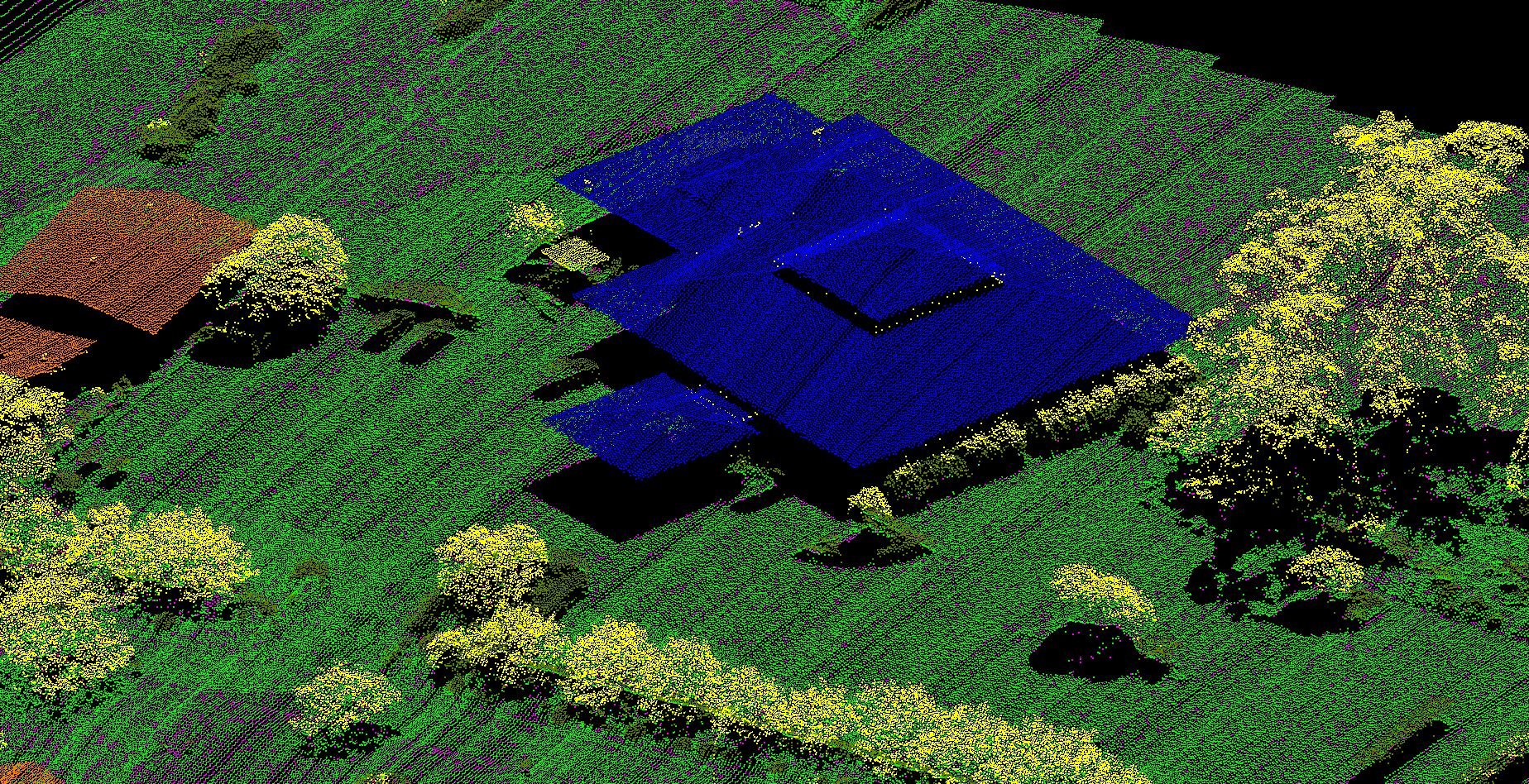
As laser is light, it travels at the speed of light. The computer uses a distance = speed x time equation to accurately determine how far away the object is from the source (rover) – this all happens almost instantly. Multiple lasers are used, rapidly returning surface information from everything within range. Our equipment has 32 lasers each activating for a nanosecond in sequence. This allows for up to 1.4M individual points to be collected per second. This information is used to build a 3D model of the environment surrounding the rover.
The intensity of each laser is strong enough that it can penetrate through a tree leaf or other thin object, as well as passing through the space between vegetation. This allows for a Digital Terrain Model (DTM) to be built in an area covered by trees or vegetation. Without LiDAR it would be impossible to get ground level readings. Measure Australia can fly above the trees and use the LiDAR to ‘see through the trees’ to the ground below.
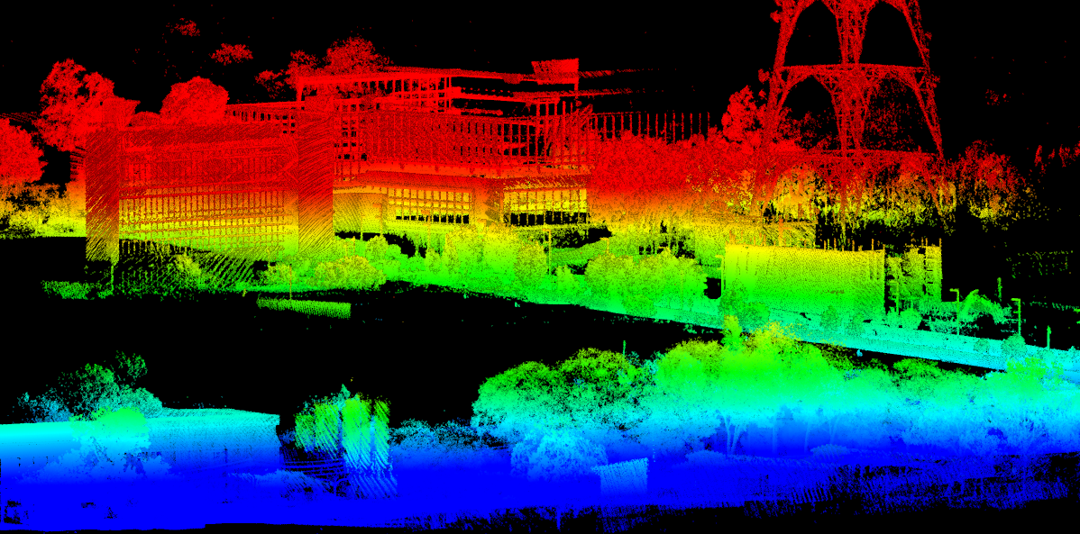
See diagram below comparing DTM collection to Digital Surface Model (DSM) collection; with LiDAR, both DSM and DTM creation is possible.
Comparison of DTM collection to DSM collection:
We can mount the rover to any vehicle and move it around to build up a detailed survey-grade 3D model of an area. Measure Australia mounts to vehicles and measure the street environment, we fly the rover on an RPAS (drone) to scan the ground from above with survey grade accuracy.
LiDAR has been in use commercially for more than 20 years in areas such as infrastructure management and surveying. Until recently, LiDAR was only available on large weighty modules requiring flight with either a manned aeroplane or helicopter. Accurate and lightweight rovers have only become available in the last couple of years, dramatically reducing the cost of a LiDAR scan, increasing the range of uses.
Previously LiDAR has been limited by the cost of needing a pilot and full-sized aircraft to fly the system. This manned system limits its use to very large areas, as high cost prevent small area surveying. An example would be where a client would like to build on a block of land, and they need to know the land levels or check the accuracy against the plans on a new section of road that has been built.
The drone based uses of LiDAR are emerging. Measure Australia can fly the rover along a street and measure tree branch proximity to power lines. This allows electricity companies to predict vegetation management, rather than being reactive after an outage. In addition, Measure Australia can fly the rover over a building site and check tolerances between plans versus as built. Further uses include driving the rover around a city and building a 3D model for civic planning.
With Measure Australia LiDAR laser scanning system, the possibilities are endless.